- Printed on Regular Paper (32lb)
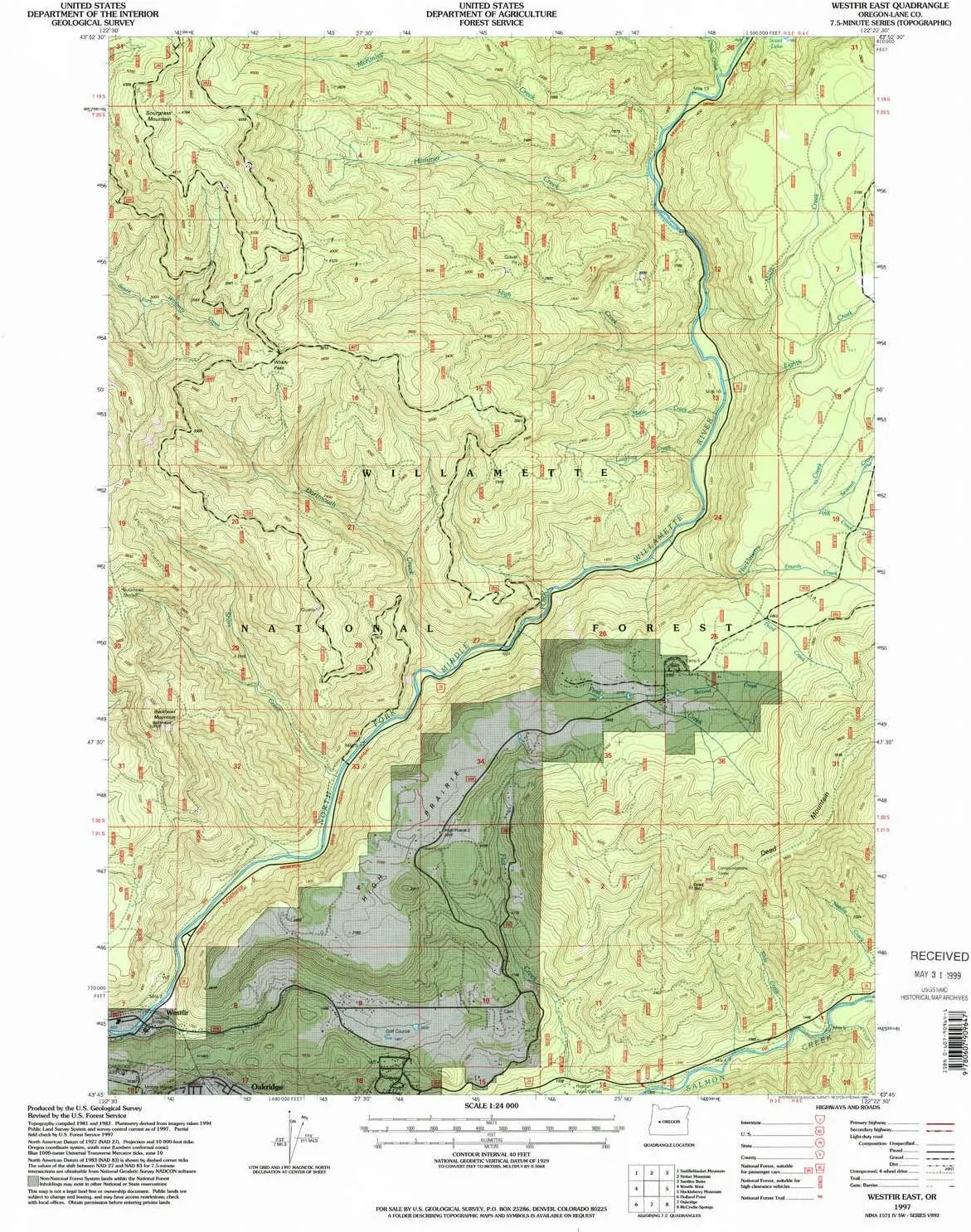
- USGS topographic map of Westfir East, OR, at 1:24000 scale. High-quality paper print. Perfect for wall maps.
- Cities, towns, villages: Westfir
- Rivers, creeks: Leapfrog Creek,McLane Creek,Huckleberry Creek,Chalk Creek,Short Creek,Ninth Creek,Sixth Creek,Fourth Creek,Dartmouth Creek,Fifth Creek,Third Creek,High Creek,Second Creek,McKinley Creek,Maple Creek,Seventh Creek,Salal Creek,First Creek,Hamner Creek,Eighth Creek,Slide Creek
- Lakes: Scout Lake
USGS topographic map of Westfir East, Oregon, dated 1997, updated 1998.
Includes geographic coordinates (latitude and longitude), lines of elevation, bodies of water, roads, and more. This topo quad is suitable for recreational, outdoor uses, office applications, or wall map framing.
Printed on-demand by YellowMaps on the print material of your choice.
Shipping rolled from Minneapolis, MN, United States.
Product Number: USGS-5422738
Map Size: 26.7 inches high x 21.9 inches wide
Map Scale: 1:24000
Map Type: POD USGS Topographic Map
Map Series: HTMC
Map Version: Historical
Cell ID: 48407
Scan ID: 282056
Imprint Year: 1998
Woodland Tint: Yes
Aerial Photo Year: 1994
Field Check Year: 1997
Survey Year: 1997
Datum: NAD27
Map Projection: Lambert Conformal Conic
Map published by United States Geological Survey
Map published by United States Forest Service
Map Language: English
Scanner Resolution: 600 dpi
Map Cell Name: Westfir East
Grid size: 7.5 X 7.5 Minute
Date on map: 1997
Geographical region: Oregon, United States
Northern map edge Latitude: 43.875°
Southern map edge Latitude: 43.75°
Western map edge Longitude: -122.5°
Eastern map edge Longitude: -122.375°
Surrounding map sheets (copy & paste the Product No. in the search bar):
North: USGS-5421696,USGS-5421694
East: USGS-5419146,USGS-5419148
South: USGS-5420586,USGS-5545162,USGS-5545164,USGS-5545160
West: USGS-6088459,USGS-6088457,USGS-6063313,USGS-5422740,USGS-5422742


